
The Caribbean
The Sally reached the West Indies in early October 1765, after a seven-week passage across the Atlantic. Sixty-eight enslaved Africans perished during the passage, joining the twenty who had died before the ship left the coast. Another twenty would die in the days after the ship's arrival.
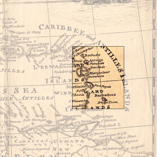
The Sally's first port of call was Barbados, the easternmost of the Windward Islands of the West Indies. Captain Hopkins expected to find letters of instructions from the Browns awaiting him, advising him on where to sell his cargo and what to acquire in exchange. Over the course of the previous months, the Browns had posted at least half a dozen such letters to the island, some touting the high prices slaves were reportedly fetching in Jamaica, others suggesting that Hopkins forego the Caribbean altogether and sell his slaves in Virginia or the Carolinas. But none of the letters seems to have reached Hopkins.
Finding no instruction in Barbados, Hopkins proceeded northwest to the island of Antigua, another British sugar-producing colony. There he sold all the surviving captives on the boat, save for a few he had been instructed to bring back to Providence. As he later explained to the Browns, at the rate that captives on the ship were dying, he could not risk putting out to sea with them again.
Map Details
An Accurate Map of the West Indies, Drawn from the latest and most approved Maps & Charts
Emanuel Bowen, 1752
Louisiana State Museum