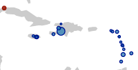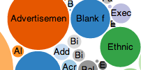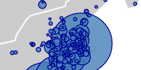
The Mapping Colonial Americas Publishing Project aims to visualize New World printing over geographic space and across literary genres from European contact to 1800.
The project began as a teaching tool to allow students unfamiliar with the history of colonial British-American reading and printing practices to see the range of genres published in Europe's American colonies and to demonstrate the regional differences in reading and publishing habits.
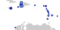
While the project's pedagogical goals remain crucial, early data visualizations suggest that the project could be expanded to investigate deeper patterns in New World colonial publishing.
The visualizations below represent early drafts. We invite you to explore the site and offer your own thoughts and suggestions on the project.